
Wisconsin Bow Echo
On July 10, 2008 a squall line moved across portions of Minnesota and Wisconsin. This line of storms produced wind gusts of 60-70 mph at numerous locations. Widespread wind damage was reported by law enforcement and local emergency management personnel.
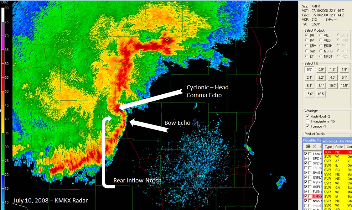
The bow echo had numerous rear inflow notches, as shown below on the Milwaukee, Wisconsin Doppler Radar. You can also read the Storm Prediction Center's Mesoscale Discussion concerning the event.
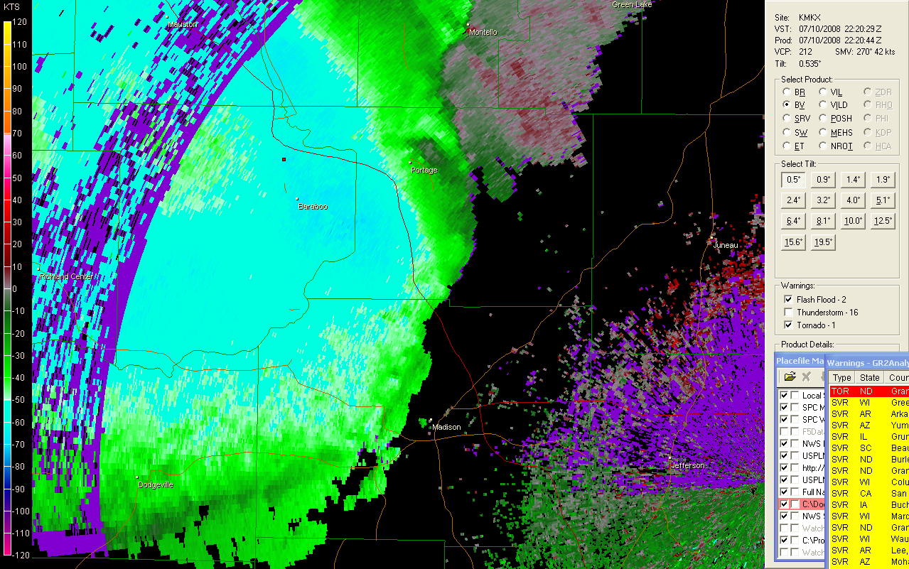
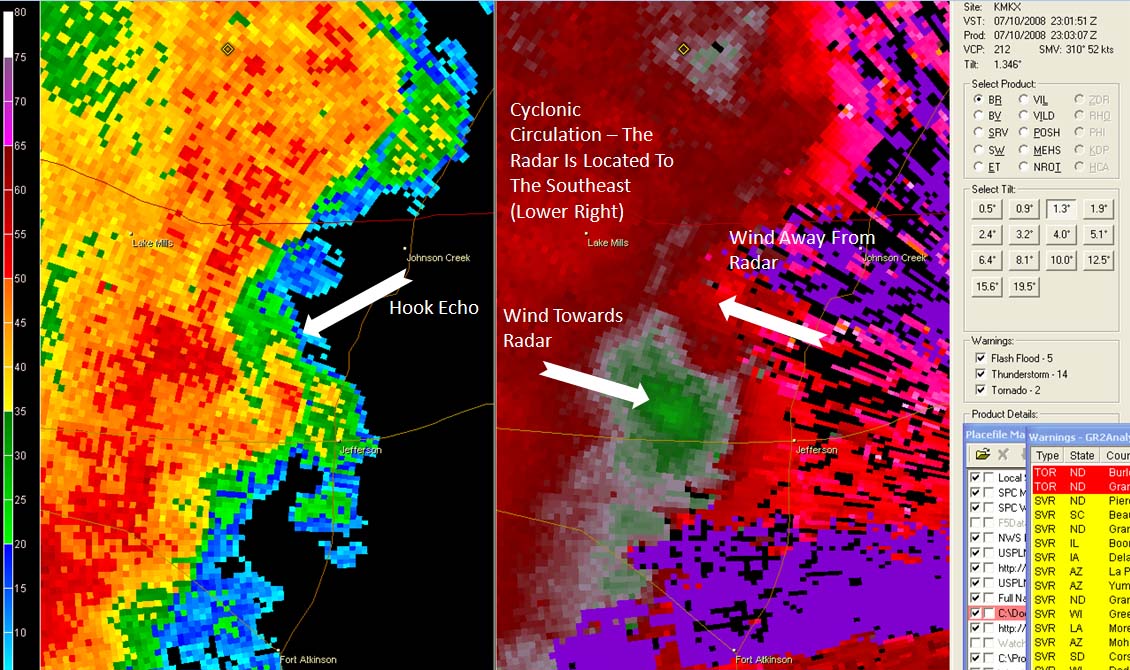
In image 3 you will see a hook echo that developed along the leading edge of the squall line/bow echo, later in its life cycle. A cyclonic circulation (mesocyclone) can be seen on the storm-relative velocity (SRM) map. SRM data is useful in detecting rotation within a thunderstorm. In this particular case no tornado warning was issued. Wind damage, however, was reported with this storm.
Radar
Base velocity
Hook echo
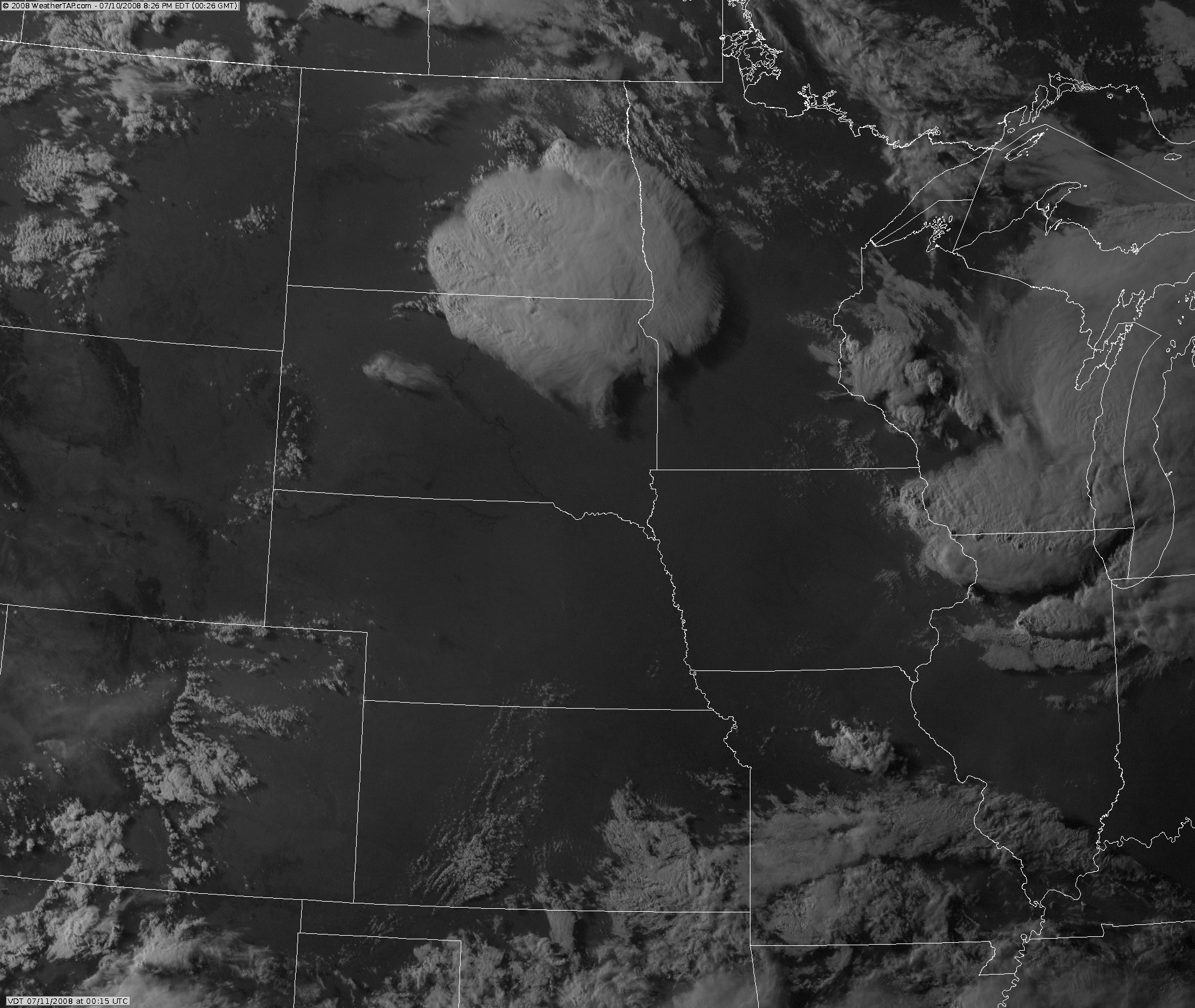
Satellite
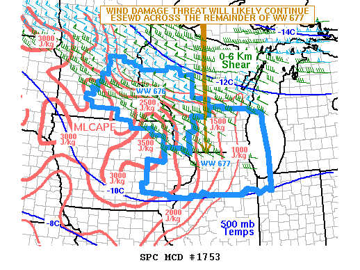
SPC Meso discussion
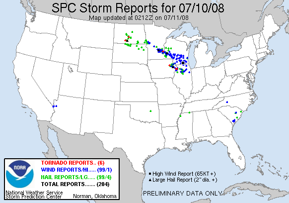
SPC - Storm reports