
High-Risk Days From 2004-2005: |
||
|
March 04, 2004: This was a rather typical outbreak setup for early March in the southern Plains. A strong low pressure system was poised to move across the region producing intense shear profiles. However instability was rather marginal, so the convection was for the most part unable to form into discrete supercells and instead formed a long squall line that raced across Texas and southern Oklahoma producing an intense derecho with embedded tornadoes. |
||
| Archived NSSFC Products | Storm Chaser Accounts | Other Links |
|
Day 1 Convective
Outlooks:
2004/day1otlk_20040304_0100 (March 3rd 7 PM) 2004/day1otlk_20040304_1200 2004/day1otlk_20040304_1300 2004/day1otlk_20040304_1630 2004/day1otlk_20040304_2000 Day 2 Convective Outlooks: 2004/day2otlk_20040304_0800 2004/day2otlk_20040304_1730 Storm Reports Weather Maps From NCEP March 03-05 - Weather Maps Radar Images NCDC Radar Images March 04-05 Over 10,000 products - Maps/Radar/Sat/Text. In Zip Format: Zip Files More Products From SPC SPC Storm Reports Composites: Surface & Upper Air Parameters 12Z Surface Surface Analyses: HPC Synoptic Scale Upper Air Analyses: 925mb: 12Z 00Z 850mb: 12Z 00Z 700mb: 12Z 00Z 500mb: 12Z 00Z 300mb: 12Z 00Z 250mb: 12Z 00Z Skew-T/Log-P Plots Image Loops: Total Area Center:TX SFC RAD SAT SPC Products: Day 1 Outlooks: 0600Z 1300Z 1630Z 2000Z 0100Z Mesoscale Disc. Watches |
Shane Adams Charles Allison Scott Blair David Drummond Chris Nuttall Scott Peake Putnam Reiter - Missing Chad Ringley - Missing Chris Sanner Robert Satkus - Missing Dean Schoeneck Jason Sippel - Missing Jeff Snyder Paul Stofer "Texhoma Storm Chasers" Justin Turcotte Ben Vassmer - Missing |
Historic Weather Maps (Viewing the Daily weather maps requires the free Djvu Browser Plug-In) Oklahoma HWO Storm Track Forecast Storm Track Reports |
| May 22, 2004: A significant severe thunderstorm event was expected for portions of Nebraska and Iowa, with a moderate risk forecast, but the tornado outbreak that erupted was even more dangerous than anticipated and a high risk was issued at 0100 UTC (8:00 PM CDT) in the final outlook update. Several dozen tornadoes occurred in a swath from south-central Nebraska northeastward to central Iowa. The unfortunate town of Hallam, Nebraska was virtually swept off the map when an enormous, violent tornado struck the town overnight. Damage surveys indicated that the tornado was nearly 2 1/2 miles wide at times! It was rated F4 as surveyors were somehow able to conclude that the houses it leveled were apparently not well built enough to designate it an F5. One person was killed in Hallam by this tornado, making it the second killer tornado of 2004. | ||
| Archived NSSFC Products | Storm Chaser Accounts | Other Links |
|
Day 1 Convective Outlooks: 2004/day1otlk_20040522_0100 (May 21st 7 PM) 2004/day1otlk_20040522_1200 2004/day1otlk_20040522_1300 2004/day1otlk_20040522_1630 2004/day1otlk_20040522_2000 Storm Reports Day 2 Convective Outlooks: 2004/day2otlk_20040522_0800 2004/day2otlk_20040522_1730 Day 3 Convective Outlook: 2004/day3otlk_20040522_1200 Weather Maps From NCEP May 22-24 - Weather Maps Radar Images NCDC Radar Images May 22-23 More Products From SPC SPC Storm Reports Composites: Surface & Upper Air Parameters Surface Analyses: HPC Synoptic Scale Upper Air Analyses: 925mb: 12Z 00Z 850mb: 12Z 00Z 700mb: 12Z 00Z 500mb: 12Z 00Z 300mb: 12Z 00Z 250mb: 12Z 00Z Skew-T/Log-P Plots Image Loops: Total Area Center:CGI-- SFC RAD SAT Area 1 Center:PIA- SFC RAD Area 2 Center:IA SFC RAD Area 3 Center:WV SFC RAD SPC Products: Day 1 Outlooks: 0600Z 1300Z 1630Z 2000Z 0100Z Mesoscale Disc. Watches |
Shane Adams Charles Allison Jim Bishop & Simon Brewer Scott Blair Chris Collura Mike Cox Dave Crowley Jon Davies Charles Doswell III - Missing Jerry Funfsinn Gabe Garfield Jon Garner William Hark Roger Hill Mike Hollingshead Damon Hynes Justyn Jackson - Missing Scott Kampas - Missing Fritz Kruse Amos Magliocco Craig Maire II - Missing Kenneth McCallister Jason Montano John Monteverdi Stan Olson Michael Peregrine Mickey Ptak Karen & Gene Rhoden Dan Robinson - Missing Robert Satkus - Missing David Schuttler Jeff Snyder Richard Theis "Thunderbolt Chase Tours" Justin Turcotte Wayne Verno & Dustin Maddox |
Historic Weather Maps (Viewing the Daily weather maps requires the free Djvu Browser Plug-In) Storm Track Forecast Storm Track Now Hastings, NE NWS Summary Hastings, NE NWS Summary Other Omaha/Valley, NE NWS Summary High Plains Regional Climate Center Study Lincoln Journal-Star Article USA Today Article WaKeeney, Kansas Tornado Video Beaver City, Nebraska Tornado Alma, Nebraska Tornado Video Stamford, Nebraska Tornado Video Hallam, Nebraska Tornado Video Nebraska Tornado Video Hallam, Nebraska Dramatic Video - Tornado Hits Building Wikipedia Article |
| May 24, 2004: The fourth severe thunderstorm and tornado outbreak in as many days strikes the Midwest, this time in northeastern Kansas, southeastern Nebraska, southern Iowa, northern Missouri, and west-central Illinois. An F1 tornado caused one fatality near Winchester, Illinois when it destroyed a mobile home. | ||
| Archived NSSFC Products | Storm Chaser Accounts | Other Links |
|
Day 1 Convective Outlooks: 2004/day1otlk_20040524_0100 2004/day1otlk_20040524_1200 2004/day1otlk_20040524_1300 2004/day1otlk_20040524_1630 PDS Tornado Watch #273 Mesoscale Discussion #874 2004/day1otlk_20040524_2000 PDS Tornado Watch #281 Mesoscale Discussion #880 Storm Reports Day 2 Convective Outlooks: 2004/day2otlk_20040524_0800 2004/day2otlk_20040524_1730 Weather Maps From NCEP May 24-26 - Weather Maps Radar Images NCDC Radar Images May 24-25 More Products From SPC SPC Storm Reports Composites: Surface & Upper Air Parameters Surface Analyses: HPC Synoptic Scale Upper Air Analyses: 925mb: 12Z 00Z 850mb: 12Z 00Z 700mb: 12Z 00Z 500mb: 12Z 00Z 300mb: 12Z 00Z 250mb: 12Z 00Z Skew-T/Log-P Plots Image Loops: Total Area Center:CGI-- SFC RAD SAT Area 1 Center:STL- SFC RAD Area 2 Center:MO SFC RAD Area 3 Center:NJ SFC RAD SPC Products: Day 1 Outlooks: 0600Z 1300Z 1630Z 2000Z 0100Z Mesoscale Disc. Watches |
Shane Adams Charles Allison Scott Blair Chris Collura Jon Davies Charles Doswell III Charles Edwards Dave Ewoldt John Garner Chris Gullikson William Hark J.R. Hehnly Mike Hollingshead Scott Kampas Aaron Kennedy - Missing Chris Koetters - Missing Tony Laubach Don Lloyd Amos Magliocco John Monteverdi Eric Nguyen - Missing Stan Olson Putnam Reiter - Missing Karen & Gene Rhoden Dan Robinson - Missing Robert Satkus - Missing Skip Talbot "Texhoma Storm Chasers" "Thunderbolt Chase Tours" Justin Turcotte Ben Vassmer Wayne Verno & Dustin Maddox Jeff Wear |
Historic Weather Maps Storm Track Forecast Storm Track Now Kansas City, MO NWS Summary Lincoln, IL NWS Summary St. Louis, MO NWS Summary Chillicothe, Missouri Tornado Video Wikipedia Article |
| May 29,
2004: The Great Memorial Day Weekend Tornado Outbreak of 2004,
Part 1. An intense storm system (surface low <990 MB) was to track
across the country through the Plains and Midwest during this
holiday weekend. With many people enjoying themselves out of doors
or attending sporting events (such as the Indy 500 on Sunday the
30th) this had all the makings of a potential major disaster. Prior
to the event several people suggested that the SPC might overhype
the event somewhat in an attempt to get the message through to the
general public, but in retrospect the outbreak that did develop was
certainly widespread enough and intense enough to warrant the high
risk and "PDS" wording regardless of outside circumstances. It was
just sheer luck that only a few people were killed or seriously
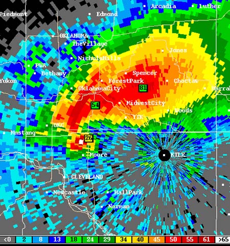
injured. On Saturday, May 29th the synoptic storm ejected into the Plains, so the classic "Tornado Alley" region of Oklahoma, Kansas and Nebraska was where the outbreak first developed. Capping of the atmosphere prevented storm coverage from becoming very widespread, but the storms that exploded off the dryline intensified into a broken line of five or six widely spaced, very large, very intense supercell thunderstorms that spawned tornado after tornado along tracks nearly 100 miles long or more. The southernmost storm tracked across nearly the entire length of Oklahoma, from near the Texas/Oklahoma state line to the Oklahoma/Arkansas line. It was an HP supercell whose tornadoes were often rain-wrapped and difficult to spot, although it did produce an anticyclonic tornado that was quite photogenic. The storm brushed the northern Oklahoma City area producing F2 tornado damage in the northern suburbs. The strongest tornado produced by this storm was an F3 near Depew, Oklahoma. The next storm to the north, in south-central Kansas, became the "Chaser's Storm of the Day" when it produced a cluster of highly visible tornadoes including a spectacular multiple vortex display. Other supercells produced "tornado families" in north-central Kansas and central Nebraska, while another tracked from northeast Kansas into northwestern Missouri, where an F4 tornado killed 3 people at the rather ironically named town of Weatherby. |
||
| Archived NSSFC Products | Storm Chaser Accounts | Other Links |
| Day 1 Convective Outlooks: 2004/day1otlk_20040529_0100 Public Severe Weather Outlook 2004/day1otlk_20040529_1200 2004/day1otlk_20040529_1300 2004/day1otlk_20040529_1630 Public Severe Weather Outlook PDS Tornado Watch #322 2004/day1otlk_20040529_2000 PDS Tornado Watch #323 Tornado Watch #326 Mesoscale Discussion #976 Mesoscale Discussion #978 Mesoscale Discussion #980 Mesoscale Discussion #982 Storm Reports Day 2 Convective Outlooks: 2004/day2otlk_20040529_0800 2004/day2otlk_20040529_1730 Weather Maps From NCEP May 28-30 - Weather Maps Radar Images NCDC Radar Images May 29-30 More Products From SPC SPC Storm Reports Composites: Surface & Upper Air Parameters Surface Analyses: HPC Synoptic Scale Upper Air Analyses: 925mb: 12Z 00Z 850mb: 12Z 00Z 700mb: 12Z 00Z 500mb: 12Z 00Z 300mb: 12Z 00Z 250mb: 12Z 00Z Skew-T/Log-P Plots Image Loops: Total Area Center:SPI- SFC RAD SAT Area 1 Center:NE SFC RAD Area 2 Center:OK SFC RAD SPC Products: Day 1 Outlooks: 0600Z 1300Z 1630Z 2000Z 0100Z Mesoscale Disc. Watches |
Shane Adams Charles Allison Sam Barricklow Jim Bishop & Simon Brewer Scott Blair Dorian Burnette Dave Chapman Chris Collura Dave Crowley Jon Davies Charles Doswell III - Missing Bobby Eddins Charles Edwards John Farley Eric Flescher George Flickinger Steve Gaddy John Garner William Hark J.R. Hehnly Roger Hill Damon Hynes Scott Kampas Aaron Kennedy - Missing Tony Laubach Jeff Lawson Amos Magliocco Kenneth McCallister Mike Mezuel II John Monteverdi Melissa Moon - Missing Gene Moore: Page 1 2 3 Eric Nguyen - Missing Greg Nordstrom Chris Nuttall Stan Olson Michael Peregrine Jason Politte Putnam Reiter - Missing Karen & Gene Rhoden Dan Robinson - Missing Robert Satkus David Schuttler Jeff Snyder Doug Speheger Paul Stofer "Texhoma Storm Chasers" Richard Thies "Thunderbolt Chase Tours" Justin Turcotte Mike Umscheid Ben Vassmer Sheila Ward Jeff Wear Matt Ziebell |
Historic Weather Maps Storm Track Forecast Kansas City, MO NWS Summary Topeka, KS NWS Summary Wichita, KS NWS Summary Harper County, Kansas Tornado Video Conway Springs, Kansas Tornado Video 1 2 3 4 5 6 7 8 9 Kansas Tornado Chase Video Harper County, Kansas Tornado Video Oklahoma Anticyclonic Tornado Video Argonia, Kansas Wedge Tornado Wedge Kansas Rope Tornado Southern Kansas Chasing Kansas Tornado Video Conway Springs, Kansas Tornado Video Wikipedia Article |
| May 30,
2004: The Great Memorial Day Weekend Tornado Outbreak of 2004
continued. The surface low had deepened and was tracking into
Minnesota. A broad warm sector of moist and unstable air overspread
much of the continental U.S.A. from areas just west of the
Mississippi River eastward to the Atlantic Coast, creating the
conditions for a risk of severe thunderstorms and tornadoes over a
very large area. With every update the SPC expanded the high risk zone on their convective outlook. By the 2000 UTC (3:00 PM CDT) outlook (see product archive below) the high risk area covered parts of 11 states. This high risk included a vast area of 35% tornado probability with hatching (for "significant F2+ tornadoes possible). Much of the eastern half of the continental U.S. was under some kind of severe weather watch, mostly PDS tornado watches. The active warnings monitor was lighting up with dozens of severe thunderstorm and tornado warnings from Texas to Minnesota to South Carolina. I was getting freaked out by this time, not only was I sure that Super Outbreak II was beginning to unfold before my eyes; but southern Wisconsin had been upgraded to high risk in the 2000 UTC outlook, and a PDS tornado watch issued. Outside, I could see cloud layers at different altitudes moving very quickly in different directions, a sign of intense wind shear. However, the cirrus shield overhead never really broke (unlike 1 week before on May 23rd) so instability did not increase to sufficient levels to fuel severe storms, and only 1 severe report came from Wisconsin (1" hail in Jefferson County). This was the fourth bust out of the five times any part of the state of Wisconsin has been put under a high risk since 2000. It was a different story over the rest of the region, however. A huge squall line stretched from Arkansas to northern Illinois. Ahead of the squall line, clusters of tornadic "mini-supercells" (smaller than those which spawned tornadoes on Saturday) struck parts of Illinois, Indiana and Kentucky. The only thing that prevented this tornado outbreak from surpassing the Super Outbreak of April 3, 1974 was the fast-moving squall line, which quickly overtook and undercut many of the tornadic supercells. Indiana suffered the worst of the tornadoes. There a supercell produced a cluster of tornadoes in the Indianapolis metro area, narrowly missing the Speedway where the Indy 500 was in progress. In southern Indiana, an F3 tornado (the strongest of the day) flattened the town of Marengo, killing 1. In eastern Missouri near the Mississippi River, an F1 tornado caused one fatality when it caused a tree limb to fall on a car. In addition to the tornado outbreak, an incredible derecho occurred courtesy of the enormous squall line, with 578 reports of damaging straight-line winds. Dense swaths of wind damage afflicted parts of Illinois, Missouri, Arkansas, Indiana, Kentucky, Tennessee, Ohio, and Mississippi. |
||
| Archived NSSFC Products | Storm Chaser Accounts | Other Links |
|
Day 1 Convective Outlooks: 2004/day1otlk_20040530_0100 Public Severe Weather Outlook 2004/day1otlk_20040530_1200 2004/day1otlk_20040530_1300 PDS Tornado Watch #330 PDS Tornado Watch #331 2004/day1otlk_20040530_1630 Public Severe Weather Outlook PDS Tornado Watch #334 2004/day1otlk_20040530_2000 Mesoscale Discussion #998 Active Weather Graphic Mesoscale Discussion #1000 Storm Reports Day 2 Convective Outlooks: 2004/day2otlk_20040530_0800.html 2004/day2otlk_20040530_1730.html Weather Maps From NCEP May 29-June 01 - Weather Maps Radar Images NCDC Radar Images May 30-31 More Products From SPC SPC Storm Reports Composites: Surface & Upper Air Parameters Surface Analyses: HPC Synoptic Scale Upper Air Analyses: 925mb: 12Z 00Z 850mb: 12Z 00Z 700mb: 12Z 00Z 500mb: 12Z 00Z 300mb: 12Z 00Z 250mb: 12Z 00Z Skew-T/Log-P Plots Image Loops: Total Area Center:KY- SFC RAD SAT Area 1 Center:IL SFC RAD Area 2 Center:KY SFC RAD Area 3 Center:AR SFC RAD SPC Products: Day 1 Outlooks: 0600Z 1300Z 1630Z 2000Z 0100Z Mesoscale Disc. Watches |
Chris Collura Bill Doms Brad Emel Nick Grillo Scott Kampas Melanie Metz Dan Robinson David Schuttler - Missing Gary Stofer Paul Stofer Skip Talbot Richard Thies Scott Weberpal Matt Ziebell |
Historic Weather Maps Storm Track Forecast Lincoln, IL NWS Summary Indianapolis, IN NWS Summary Syracuse, IN NWS Summary Louisville, KY NWS Summary Paducah, KY NWS Summary Springfield, MO NWS Summary St. Louis, MO NWS Summary Nashville, TN NWS Summary WTHR Ch. 13-Indianapolis Story WHIO Severe Weather Video Indianapolis, Indiana Tornado Video Secor, Illinois Tornado WLFI Tornado Aftermath Part 2 WHIO Television Coverage 2 3 4 5 6 Wikipedia Article |
| April 11,
2005: A strong low was moving across the Plains toward the lower
Mississippi Valley. A large squall line accompanied the cold front
through Louisiana and toward Mississippi. SPC upgraded to high risk
as they expected tornadic supercells to develop ahead and within the
squall line. This did not happen, and this was the first SPC high
risk forecast since July 31, 2002 that I would call a total bust.
Severe weather was very sporadic in the lower Mississippi Valley,
but one person was killed in Jackson, Mississippi by a falling tree
that had been blown over by straight-line winds. Severe weather was more widespread further north across Nebraska, Kansas, and Missouri, where several people chased (mostly non-tornadic) supercells. |
||
| Archived NSSFC Products | Storm Chaser Accounts | Other Links |
| Day 1 Convective Outlooks: 2005/day1otlk_20050411_0100 2005/day1otlk_20050411_1200 Mesoscale Discussion #554 PDS Tornado Watch #150 2005/day1otlk_20050411_1300 2005/day1otlk_20050411_1630 Mesoscale Discussion #556 Public Severe Weather Outlook Mesoscale Discussion #558 PDS Tornado Watch #153 2005/day1otlk_20050411_2000 Storm Reports Day 2 Convective Outlooks: 2005/day2otlk_20050411_0800 2005/day2otlk_20050411_1730 Weather Maps From NCEP April 10-12 - Weather Maps Radar Images NCDC Radar Images April 11-12 More Products From SPC SPC Storm Reports Composites: Surface & Upper Air Parameters Surface Analyses: HPC Synoptic Scale Upper Air Analyses: 925mb: 12Z 00Z 850mb: 12Z 00Z 700mb: 12Z 00Z 500mb: 12Z 00Z 300mb: 12Z 00Z 250mb: 12Z 00Z Skew-T/Log-P Plots Image Loops: Total Area Center: AR SFC RAD SAT Area 1 Center: LA SFC RAD Area 2 Center: KS SFC RAD SPC Products: Day 1 Outlooks: 0600Z 1300Z 1630Z 2000Z 0100Z Mesoscale Disc. Watches |
Darin Brunin Dan Hinch Mike Hollingshead Amos Magliocco Mikel Shively |
Historic Weather Maps Storm Track Forecast |
| June 4, 2005: A tornado outbreak produced 44 tornadoes across the Central United States. Additional information on this event will be posted soon. | ||
| Archived NSSFC Products | Storm Chaser Accounts | Other Links |
| Day 1 Convective Outlooks: 2005/day1otlk_20050604_0100 2005/day1otlk_20050604_1200 Mesoscale Discussion #1150 Mesoscale Discussion #1151 Mesoscale Discussion #1152 Mesoscale Discussion #1153 Mesoscale Discussion #1154 Mesoscale Discussion #1155 Mesoscale Discussion #1156 Mesoscale Discussion #1157 Mesoscale Discussion #1158 Mesoscale Discussion #1159 Mesoscale Discussion #1160 Mesoscale Discussion #1161 Mesoscale Discussion #1162 Mesoscale Discussion #1163 Mesoscale Discussion #1164 Mesoscale Discussion #1165 Mesoscale Discussion #1166 Mesoscale Discussion #1167 Mesoscale Discussion #1168 Mesoscale Discussion #1169 Mesoscale Discussion #1170 Mesoscale Discussion #1171 PDS Tornado Watch #391 PDS Tornado Watch #393 2005/day1otlk_20050604_1300 2005/day1otlk_20050604_1630 Public Severe Weather Outlook Public Severe Weather Outlook 2005/day1otlk_20050604_2000 Storm Reports Day 2 Convective Outlooks: 2005/day2otlk_20050604_0800 2005/day2otlk_20050604_1730 Weather Maps From NCEP April 10-12 - Weather Maps Radar Images NCDC Radar Images April 11-12 More Products From SPC SPC Storm Reports Composites: Surface & Upper Air Parameters Surface Analyses: HPC Synoptic Scale Upper Air Analyses: 925mb: 12Z 00Z 850mb: 12Z 00Z 700mb: 12Z 00Z 500mb: 12Z 00Z 300mb: 12Z 00Z 250mb: 12Z 00Z Skew-T/Log-P Plots Image Loops: Total Area Center: KS SFC RAD SAT Area 1 Center: MO SFC RAD Area 2 Center: IA SFC RAD Area 3 Center: KS SFC RAD Area 4 Center: OK SFC RAD SPC Products: Day 1 Outlooks: 0600Z 1300Z 1630Z 2000Z 0100Z Mesoscale Disc. Watches |
XXXXXX |
Historic Weather Maps Storm Track Forecast |
| November 15, 2005: Still working on this date. | ||
| Archived NSSFC Products | Storm Chaser Accounts | Other Links |
| Day 1 Convective Outlooks: 2005/day1otlk_20050411_0100 2005/day1otlk_20050411_1200 Mesoscale Discussion #554 PDS Tornado Watch #150 2005/day1otlk_20050411_1300 2005/day1otlk_20050411_1630 Mesoscale Discussion #556 Public Severe Weather Outlook Mesoscale Discussion #558 PDS Tornado Watch #153 2005/day1otlk_20050411_2000 Storm Reports Day 2 Convective Outlooks: 2005/day2otlk_20050411_0800 2005/day2otlk_20050411_1730 Weather Maps From NCEP April 10-12 - Weather Maps Radar Images NCDC Radar Images April 11-12 More Products From SPC SPC Storm Reports Composites: Surface & Upper Air Parameters Surface Analyses: HPC Synoptic Scale Upper Air Analyses: 925mb: 12Z 00Z 850mb: 12Z 00Z 700mb: 12Z 00Z 500mb: 12Z 00Z 300mb: 12Z 00Z 250mb: 12Z 00Z Skew-T/Log-P Plots Image Loops: Total Area Center: AR SFC RAD SAT Area 1 Center: LA SFC RAD Area 2 Center: KS SFC RAD SPC Products: Day 1 Outlooks: 0600Z 1300Z 1630Z 2000Z 0100Z Mesoscale Disc. Watches |
Darin Brunin Dan Hinch Mike Hollingshead Amos Magliocco Mikel Shively |
Historic Weather Maps Storm Track Forecast |
Please notify me of errors and or corrections that may be necessary. If you have links that would have to the archive then please email me. News story links, Wiki information, personal chase accounts, or other data that might be helpful to the weather community. Beau Dodson Return to Events Page Return to Home Page For Page Errors Please Contact Beau Dodson |
||
insert content here