
High-Risk Days of the 1980s and 1990s:
April 06, 1972, the Severe Local Storms Unit of the National Severe Storms Forecast Center began issuing a new forecast product designed to provide an at-a-glance assessment of the thunderstorm potential across the continental United States. Early outlooks were quite simple. As forecasting technology improved, the outlooks became more detailed. The modern Storm Prediction Center convective outlook provides a complete breakdown of where thunderstorms/severe thunderstorms are expected, why they are expected, what the main threats are expected to be, and more.Modern convective outlooks divide the thunderstorm potential into four threat levels. General (non-severe) thunderstorms, slight risk of severe thunderstorms, moderate risk of severe thunderstorms, and high risk of severe thunderstorms. This archive focuses on those days when a high risk was included in the outlook, because a high risk is only issued when the forecasters expect a major (perhaps even historical) tornado outbreak and/or damaging convective windstorm (derecho).
This section includes those high-risk days prior to 1999. Any high risks issued before 1988 are missing because of a lack of information. The archives are quite sketchy up until about 1997, because there are relatively few convective outlooks and storm chaser accounts still online for the older events.
To read more information on the history of the Storm Prediction Center please visit this link.
May 07, 1988: The high risk forecast in Oklahoma busted (the outbreak didn't happen). That's all I know. No NSSFC products available.
| Archived NSSFC Products | Storm Chaser Accounts | Other Links |
| Storm Reports | Robert Satkus |
Historical Weather Maps (Viewing the Daily weather maps requires the free Djvu Browser Plug-In) |
November 15, 1989: A tornado outbreak struck the Southeast on this day. Huntsville, Alabama was hit by a destructive F4 tornado.
| Archived NSSFC Products | Storm Chaser Accounts | Other Links |
March 13, 1990: We could not find any references to the outlook risk level on this day, much less any actual SELS/NSSFC outlooks. We have been told that it was a moderate risk event. A massive 59-tornado outbreak (including 2 F5s, 2 F4s and 10 F3s) across Kansas, Oklahoma, Nebraska, and Iowa. Casey Osburn sent me this message: I remember in ensuing days, there was talk among my meteorologist friends that it certainly *should* have been a high risk due to the results of the day. But March 13, 1990, was most certainly a moderate risk for portions of the central plains. And back then (as you probably know,) if there was a high risk, then there was no moderate region...a slight risk would surround the high risk region.
| Archived NSSFC Products | Storm Chaser Accounts | Other Links |
May 15, 1990: Stillwater, Oklahoma was hit by a killer F3 tornado during a localized severe weather outbreak. No NSSFC products available.
| Archived NSSFC Products | Storm Chaser Accounts | Other Links |
| Storm Reports | Robert Satkus |
Historical Weather Maps (Viewing the Daily weather maps requires the free Djvu Browser Plug-In) Newspaper Article Newspaper Article Newspaper Article Newspaper Article Newspaper Article Newspaper Article 2 Omega, Oklahoma Tornado Video |
June 01, 1990 It is my understanding from some meteorologists and severe weather researchers that June 01, 1990 was a high risk day that ended up as a bust. Casey Osburn has sent me an email with the following information: June 1, 1990, there was a high risk along the high plans from North Dakota to west Texas...total bust. This was the precursor to the high risk further east on June 2. Only a couple of watches were issued on June 1, but no significant tornadoes happened on this day.
June 02,
1990: A major tornado outbreak struck the Ohio Valley and
Midwest during the evening into the overnight hours of June
02-03, 1990. 55 tornadoes including 7 F4s touched down. Nick
Smith has kindly provided a wealth of information about the outbreak,
including saved radar images and screenshots from The Weather
Channel's coverage.
| Archived NSSFC Products | Storm Chaser Accounts | Other Links |
April 11, 1991: A high-risk bust in which a lack of the expected instability and moisture prevented storms from intensifying. No NSSFC products available.
| Archived NSSFC Products | Storm Chaser Accounts | Other Links |
| Storm Reports | Robert Satkus |
Historical Weather Maps (Viewing the Daily weather maps requires the free Djvu Browser Plug-In) |
April 12, 1991: NSSFC's SELS (forerunner to the SPC) got it right this time. An extensive tornado outbreak occurred in Oklahoma, Kansas and Texas. There is a well-known video of a tornado in this outbreak that was so picturesque that storm chaser Doug Speheger, a member of Howard Bluestien's research team exclaimed "Ooh, what a classic!" Few NSSFC products are available.
| Archived NSSFC Products | Storm Chaser Accounts | Other Links |
| Storm Reports |
Sam
Barricklow Robert Satkus - Missing |
Historical Weather Maps (Viewing the Daily weather maps requires the free Djvu Browser Plug-In) Marshall, Oklahoma Tornado Video Kingfisher, Oklahoma Tornado Video |
April 26, 1991: Significant Kansas/Oklahoma outbreak that made the 12th seem like a fair-weather day by comparison. Three of the approximately fifty tornadoes have been immortalized either by the scars they left on the communities they affected, by the incredible video taken of them, or both. These are:
The Andover, Kansas tornado, which devastated a trailer park in that community, killing 13. This tornado also hit McConnell Air Force Base and parts of south Wichita. This tornado was among the most destructive in recent memory (perhaps not surpassed until May 3, 1999) and was rated F5.
The tornado near Red Rock, Oklahoma. It fortunately occurred mostly in open country and received an official rating of F4, but the mobile Doppler radars measured winds of 287 MPH within the vortex, which is in the F5 estimated wind speed range.
The Kansas Turnpike Overpass tornado. This was produced by the same supercell that spawned the Wichita/Andover tornado mentioned above, but contrary to what some sources will tell you, it was NOT the same tornado. It also was not a violent (F4 or F5) tornado. It did roll and tumble the cars and trucks in its path along the highway, but it did not loft them into the air and throw or carry them long distances, which is a characteristic of violent tornado damage. It also did NOT pass directly over the people taking shelter under the bridge. The acceleration of the wind seen in the video is due to inflow blowing toward the tornado. The highly publicized and incorrect notions that the tornado was violent and made a direct hit on the bridge is responsible for a widespread public belief that overpasses are safe shelter from tornadoes. More recent disasters have shown that this is not necessarily the case.
| Archived NSSFC Products | Storm Chaser Accounts | Other Links |
April 28, 1991: Another strong storm system moved into the Plains and warranted a high risk, but presence of negative parameters kept activity minimal compared to two days before. However, a few small tornadoes developed from low-topped, largely precipitation-free mini-supercells in Kansas. No NSSFC products available
| Archived NSSFC Products | Storm Chaser Accounts | Other Links |
| Storm Reports | Robert Satkus |
Historical Weather Maps (Viewing the Daily weather maps requires the free Djvu Browser Plug-In) Case Study by Jon Davies |
June 16-17, 1992: . This was a major severe thunderstorm outbreak with numerous tornadoes. The NSSFC, recorded 90+ tornadoes in this event. Few NSSFC products are available.
| Archived NSSFC Products | Storm Chaser Accounts | Other Links |
|
Storm Reports - June 16 Storm Reports June 17th |
Historical Weather Maps (Viewing the Daily weather maps requires the free Djvu Browser Plug-In) AMS paper on this event |
June 07, 1993: Widespread severe weather outbreak across much of the Plains, with a tornado outbreak in South Dakota. Few NSSFC products are available.
| Archived NSSFC Products | Storm Chaser Accounts | Other Links |
| Storm Reports | Robert Satkus - Missing |
Historical Weather Maps (Viewing the Daily weather maps requires the free Djvu Browser Plug-In) Colton-Coleman, South Dakota Tornado Video |
| Archived NSSFC Products | Storm Chaser Accounts | Other Links |
April 25, 1994: This was of the only outbreak days in the Plains in the spring of '94. It unfortunately resulted in several deaths and numerous injuries from tornadoes in northern Texas.
| Archived NSSFC Products | Storm Chaser Accounts | Other Links |
|
1500 UTC Day 1 Outlook (10:00 AM CDT) Storm Reports |
Robert Satkus - Missing |
Historical Weather Maps Second Set (Viewing the Daily weather maps requires the free Djvu Browser Plug-In) Quick Response report on the Lancaster, TX tornado Wikipedia Article |
August 27, 1994: A rare summer high risk day in the upper Midwest. According to the storm reports archive, 9 tornadoes occurred in Wisconsin, with 2 of them of F3 strength. There were 4 fatalities and 51 injuries.
| Archived NSSFC Products | Storm Chaser Accounts | Other Links |
|
Public Severe Weather Outlook #1 (6:00 AM CDT) Public Severe Weather Outlook #2 (10:15 AM CDT) 1930 UTC Day 1 Outlook (2:30 PM CDT) Storm Reports |
Historical Weather Maps (Viewing the Daily weather maps requires the free Djvu Browser Plug-In) |
November 27, 1994: A tornado outbreak in the lower Mississippi Valley produces 19 tornadoes causing 6 fatalities and 45 injuries.
| Archived NSSFC Products | Storm Chaser Accounts | Other Links |
|
1500 UTC Day 1 Outlook (9:00 AM CST) Public Severe Weather Outlook (10:00 AM CST) 1930 UTC Day 1 Outlook (1:30 PM CST) Storm Reports |
Historical Weather Maps Second Set (Viewing the Daily weather maps requires the free Djvu Browser Plug-In) Quick Response report on the Lancaster, TX tornado |
April 17, 1995: A severe weather outbreak in the southern Plains, including a prolific tornadic supercell along the Red River in northern Texas/southern Oklahoma.
| Archived NSSFC Products | Storm Chaser Accounts | Other Links |
|
Public Severe Weather Outlook (4:00 AM CDT) 1900 UTC Day 1 Outlook (2:00 PM CDT) Storm Reports Radar Image 1 image available 2300Z |
Charles
Edwards Robert Satkus - Missing Arthur Witt |
Historical Weather Maps Second Set (Viewing the Daily weather maps requires the free Djvu Browser Plug-In) |
May 07, 1995: Another tornado outbreak hit the southern Plains with several strong (F2/F3) tornadoes including one that struck Ardmore, Oklahoma.
| Archived NSSFC Products | Storm Chaser Accounts | Other Links |
|
0200 UTC Day 1 Outlook (9:00 PM CDT)
Radar Image |
Sam
Barricklow Robert Satkus |
Historical Weather Maps Second Set (Viewing the Daily weather maps requires the free Djvu Browser Plug-In) Wikipedia Article |
May 12, 1995: Still another tornado outbreak was expected across the Plains, but capping and cloud cover kept storm activity to a minimum. However, the one supercell that did manage to develop went nuts and produced nearly 10 tornadoes in Kansas.
| Archived NSSFC Products | Storm Chaser Accounts | Other Links |
|
Public Severe Weather Outlook #1 (4:00 AM CDT) 1500 UTC Day 1 Outlook (10:00 AM CDT) Public Severe Weather Outlook #2 (11:00 AM CDT) Storm Reports Radar Image 1 image available 2300Z |
Charles
Edwards William Reid Robert Satkus - Missing |
Historical Weather Maps Second Set (Viewing the Daily weather maps requires the free Djvu Browser Plug-In) Wikipedia Article |
May 13, 1995: A tornado and severe thunderstorm outbreak in Illinois, Indiana and Kentucky region resulted in several destructive tornadoes and 3 deaths.
| Archived NSSFC Products | Storm Chaser Accounts | Other Links |
|
0600 UTC Day 1 Outlook (1:00 AM CDT) Radar Image |
Robert Satkus - Missing |
Historical Weather Maps Second Set (Viewing the Daily weather maps requires the free Djvu Browser Plug-In) Wikipedia Article |
May 17, 1995: A continuation of the tornado outbreak sequence although this was mostly a bust; only 8 tornadoes and few other reports.
| Archived NSSFC Products | Storm Chaser Accounts | Other Links |
|
Storm Reports Radar Image 1 image available 2300Z |
Historical Weather Maps (Viewing the Daily weather maps requires the free Djvu Browser Plug-In) Carmen, Oklahoma Tornado Video |
April 19, 1996: The biggest tornado outbreak to affect the state of Illinois up to that time hit on this day. Over 30 tornadoes occurred in the state (Note-that record may have been broken on April 20, 2004). Significant tornadoes affected the communities of Ogden and Decatur. A TV chase crew from Minnesota got some very intense video as the whirling debris cloud of a small tornado passed just on the other side of the highway from the ditch they were crouched in.
| Archived NSSFC Products | Storm Chaser Accounts | Other Links |
|
0600 UTC Day 1 Outlook (1:00 AM CDT) 1500 UTC Day 1 Outlook (10:00 AM CDT) 1900 UTC Day 1 Outlook (2:00 PM CDT) PDS Tornado Watch #190 (5:11 PM CDT) 0200 UTC Day 1 Outlook (9:00 PM CDT) Storm Reports Radar Image 1 image available 2300Z |
Roger
Edwards Gilbert Sebenste |
Historical Weather Maps Second Set (Viewing the Daily weather maps requires the free Djvu Browser Plug-In) Quad Cities, IA/IL/MO NWS Summary Case Study by University of Illinois (includes chaser accounts and damage survey) Case Study by Jewitt, Lee & Wilhelmson Jacksonville, Illinois Tornado Video USA Today article (removed broken link) Wikipedia Article |
May 26, 1996: Severe weather outbreak in the southern Plains.
| Archived NSSFC Products | Storm Chaser Accounts | Other Links |
|
Public Severe Weather Outlook #1 (6:00 AM CDT) Public Severe Weather Outlook #2 (11:00 AM CDT) Storm Reports Radar Image 1 image available 2300Z |
Steve Gaddy John Monteverdi Robert Satkus - Missing Gilbert Sebenste |
Historical Weather Maps Second Set (Viewing the Daily weather maps requires the free Djvu Browser Plug-In) |
May 02, 1997: A widespread outbreak of severe thunderstorms struck the lower Mississippi Valley and the Southeast. It mostly consisted of large hail and damaging wind, with 8 tornadoes touching down. The strongest was an F3 at Belzoni, Mississippi. The only fatality was south of Chickamauga in far northwestern Georgia, where an F1 tornado killed a young girl when it destroyed her family's mobile home.
| Archived NSSFC Products | Storm Chaser Accounts | Other Links |
|
Public Severe Weather Outlook (5:00 AM CDT) Radar Image |
Historical Weather Maps (Viewing the Daily weather maps requires the free Djvu Browser Plug-In) |
July 01, 1997: Another rare summer high risk day in the upper Midwest. A strong cap prevented storms from forming until after dark, and the several supercells that went up at that time quickly coalesced into a small derecho ( a strong, long-lived thunderstorm-induced windstorm) across Minnesota into west-central Wisconsin.
| Archived NSSFC Products | Storm Chaser Accounts | Other Links |
|
0600 UTC Day 1 Outlook (1:00 AM CDT) 1500 UTC Day 1 Outlook (10:00 AM CDT) 1900 UTC Day 1 Outlook (2:00 PM CDT) Storm Reports Radar Images NCDC Radar Images - July 01-02 |
Don
Lloyd John Moser |
Historical Weather Maps (Viewing the Daily weather maps requires the free Djvu Browser Plug-In) Wikipedia Article |
February 10, 1998: A derecho affected parts of Texas, Louisiana and Mississippi with widespread damaging winds and several weak (F0-F1) tornadoes.
| Archived NSSFC Products | Storm Chaser Accounts | Other Links |
|
1500 UTC Day 1 Outlook (9:00 AM CST) February 9-11th - Weather Maps Radar Images NCDC Radar Images - February 10-11 |
Historical Weather Maps (Viewing the Daily weather maps requires the free Djvu Browser Plug-In) |
April 08, 1998: An outbreak of intense tornadoes hit the southeastern states, among them was the infamous Oak Grove/Birmingham, Alabama F5 disaster. The incredible carnage inflicted on the community could have been even worse, as the tornado fortunately dissipated just before reaching the downtown Birmingham area.
| Archived NSSFC Products | Storm Chaser Accounts | Other Links |
|
1500 UTC Day 1 Outlook (10:00 AM CDT) Storm Reports Weather Maps From NCEP April 7-9th - Weather Maps Radar Images NCDC Radar Images - April 08-09 |
Historical Weather Maps (Viewing the Daily weather maps requires the free Djvu Browser Plug-In) Birmingham, AL NWS Summary WSR-88D Mesocyclone Detection Algorithm case study - Missing Legates/Biddle study of warning response Quick Response report Chris Reese's Study Rick Langdon's page about the tornado Wikipedia Article |
April 15, 1998: Outbreak of mostly small tornadoes in the middle Mississippi Valley, however there were four fatalities inflicted during the overnight hours of April 15-16 by strong-violent (F3-F4) tornadoes near the Arkansas/Tennessee border.
| Archived NSSFC Products | Storm Chaser Accounts | Other Links |
|
Public Severe Weather Outlook (6:00 AM CDT) 1200 UTC Day 1 Outlook (7:00 AM CDT, graphic only) 1500 UTC Day 1 Outlook (10:00 AM CDT) Storm Reports Weather Maps From NCEP April 14-16th - Weather Maps Radar Images NCDC Radar Images - April 15-16 |
Shane Adams John Farley Stephen Jascourt Don Lloyd Jeff Piotrowski Gilbert Sebenste |
Historical Weather Maps (Viewing the Daily weather maps requires the free Djvu Browser Plug-In) Wikipedia Article |
April 16, 1998: The same storm system responsible for the previous day's high risk/overnight tornadoes spawned another, more significant tornado outbreak slightly further east. Best known is the Nashville, Tennessee tornado, which was actually three separate tornadoes, two F2 and one F3. An F5 tornado hit Lawrence County in south-central Tennessee.
| Archived NSSFC Products | Storm Chaser Accounts | Other Links |
|
1500 UTC Day 1 Outlook (10:00 AM CDT)
Storm Reports Weather Maps From NCEP April 16-18th - Weather Maps Radar Images NCDC Radar Images - April 16-17 |
Lawrence County Skywarn Report Memphis, TN NWS SummaryNashville, TN NWS Summary (Nashville tornadoes) Nashville, TN NWS Summary (Lawrence County F5) Photos & radar images of the F5 - Missing Storm Reports |
Historical Weather Maps (Viewing the Daily weather maps requires the free Djvu Browser Plug-In) News 5 Nashville, Tennessee Tornado Video 10 Year Anniversary Video Nashville, Tennessee Tornado Video Wikipedia Article |
May 31, 1998: The same storm system responsible for the killer Spencer, SD tornado and upper Midwest/Great Lakes derecho on the day before triggered a severe weather outbreak in the New York/Pennsylvania area, including several strong tornadoes. An F3 killed one person in Pennsylvania. This may be the only time ever that the SPC or SELS outlooked a high risk in the Northeast.
| Archived NSSFC Products | Storm Chaser Accounts | Other Links |
June 14, 1998: An outbreak of 22 weak (F0-F1) tornadoes in northeast Missouri and west-central Illinois, plus a derecho beginning in the St. Louis area, across Illinois to Kentucky and Tennessee.
| Archived NSSFC Products | Storm Chaser Accounts | Other Links |
|
1500 UTC Day 1 Outlook (10:00 AM CDT) Storm Reports Weather Maps From NCEP June 14-June 15 - Weather Maps Radar Images NCDC Radar Images - June 14-15 |
Don
Lloyd Jeff Piotrowski |
Historical Weather Maps Second Set (Viewing the Daily weather maps requires the free Djvu Browser Plug-In) NWS case study - Missing |
January 21, 1999: The biggest tornado outbreak in state history ravaged Arkansas. The Little Rock area was hit hard. The number of tornadoes in this single outbreak was nearly triple the January average for the entire nation.
| Archived NSSFC Products | Storm Chaser Accounts | Other Links |
March 08, 1999: As is rather common with early season situations (January 21 was a major exception!), marginal instability prevented cellular convection from forming in extreme-shear environment and a squall line was the dominant storm mode. There were a couple of tornadoes in addition to some severe wind and hail, but severe weather was not widespread enough to justify a high risk.
| Archived NSSFC Products | Storm Chaser Accounts | Other Links |
|
1300 UTC Day 1 Outlook (7:00 AM CST) 1630 UTC Day 1 Outlook (10:30 AM CST) 2000 UTC Day 1 Outlook (2:00 PM CST) Storm Reports Weather Maps From NCEP March 07-09 - Weather Maps Radar Images NCDC Radar Images - March 08-09 |
Shane Adams Eric Nguyen Dean Schoeneck |
Historical Weather Maps Second Set (Viewing the Daily weather maps requires the free Djvu Browser Plug-In) |
April 08, 1999: A widespread tornado outbreak mostly over southwest Iowa and northern Missouri. 6 fatalities were caused by the 56 tornadoes.
| Archived NSSFC Products | Storm Chaser Accounts | Other Links |
|
1300 UTC Day 1 Outlook (8:00 AM CDT) Public Severe Weather Outlook (10:45 AM CDT) 1630 UTC Day 1 Outlook (11:30 AM CDT) 2000 UTC Day 1 Outlook (3:00 PM CDT) 0100 UTC Day 1 Outlook (8:00 PM CDT) Storm Reports Weather Maps From NCEP April 07-09 - Weather Maps Radar Images NCDC Radar Images - April 09 |
Shane Adams Don Lloyd - Missing Jeff Piotrowski Account Photo 1 Photo 2 |
Historical Weather Maps (Viewing the Daily weather maps requires the free Djvu Browser Plug-In) University of Nebraska photos More University of Nebraska photos Quad Cities NWS Summary Wikipedia Article |
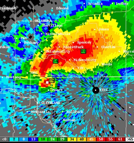
May 03, 1999: This day brought what was almost unarguably the worst tornado outbreak to hit the Plains states since April 26, 1991. 77 tornadoes rampaged through Oklahoma and southern Kansas, including one F5 and at least three F4 tornadoes, which caused major devastation in Moore, OK, Mulhall, OK, Dover, OK, and Wichita, KS. At least 40 were killed.
| Archived NSSFC Products | Storm Chaser Accounts | Other Links |
May 04, 1999: The same storm system responsible for the previous day's central Oklahoma outbreak shifted slightly eastward, but remained just as potent. Fortunately, the tornadoes produced on this day in northeast Texas, southeast Oklahoma and southwest Arkansas were not nearly as disastrous as those of the 3rd, but one person was killed in northeast Texas by an F3 tornado.
| Archived NSSFC Products | Storm Chaser Accounts | Other Links |
|
0600 UTC Day 1 Outlook (1:00 AM CDT) 1300 UTC Day 1 Outlook (8:00 AM CDT) 1630 UTC Day 1 Outlook (11:30 AM CDT) 2000 UTC Day 1 Outlook (3:00 PM CDT) Storm Reports Weather Maps From NCEP May 03-05 - Weather Maps Radar Images NCDC Radar Images May 04-05 |
Martin Lisius Eric Nguyen Jason Politte |
Historical Weather Maps (Viewing the Daily weather maps requires the free Djvu Browser Plug-In) |
May 05, 1999: This persistent and powerful storm system stuck around long enough to warrant a third straight high risk and cause a third straight severe weather outbreak day. Widespread damaging straight-line winds were more prevalent on the 5th, with fewer tornadoes than the previous 2 days (18 compared with 39 on the 4th and 77 on the 3rd), but three people lost their lives to an F4 tornado in Tennessee.
| Archived NSSFC Products | Storm Chaser Accounts | Other Links |
|
1300 UTC Day 1 Outlook (8:00 AM CDT) 1630 UTC Day 1 Outlook (11:30 AM CDT) 2000 UTC Day 1 Outlook (3:00 PM CDT) Storm Reports Weather Maps From NCEP May 04-06 - Weather Maps Radar Images NCDC Radar Images May 05-06 |
John Farley |
Historical Weather Maps (Viewing the Daily weather maps requires the free Djvu Browser Plug-In) Nashville, TN NWS Summary Wikipedia Article |
Note: Starting with June, 1999, SPC Preliminary Storm Reports are available on-line in their entirety, so I will be linking to the full listings, rather than to forecaster John Hart's graphical archive.
June 05, 1999: Although the forecasted major outbreak never materialized, a few photogenic tornadoes developed in Nebraska and South Dakota. Several chasers had successful trips. The same storm system brought another round of widespread severe weather to the upper Midwest on the next day, when Andy came face to face with it.
| Archived NSSFC Products | Storm Chaser Accounts | Other Links |
Please notify me of errors and or corrections that may be necessary. If you have links that would have to the archive then please email me. News story links, Wiki information, personal chase accounts, or other data that might be helpful to the weather community.
Beau Dodson
Return to Events Page
Return to Home Page
For Page Errors Please Contact Beau Dodson